-
Whenuapai Village
Description
Whenuapai Village is a 31.4 hectare landholding located on the western corner of Brigham Creek Road and Totara Road. Through New Zealand’s first concurrent Plan Variation and Qualifying Development resource consent process approved by Auckland Council the site was rezoned from Future Urban to Mixed Housing Urban. The site will facilitate 651 residential lots, the creation of a town park and neighbourhood park, as well as an interconnected network of public roads and stormwater infrastructure.
At a glance
- Project: Residential
- Location: Whenuapai, Auckland
- Size: 31.4 hectare
- Completed: Staged through to October 2022
Whenuapai Village Scheme DrawingWhenuapai Village Progress OverviewWhenuapai Village Progress UpdateWhenuapai Village Progress UpdateWhenuapai Village OverviewWhenuapai Village Progress DetailWhenuapai Village ProgressWhenuapai Village PlaygroundWhenuapai Village Cafe and PlaygroundNext Project -
Whenuapai Land
Description
Whenuapai Land is a 16.8 hectare landholding on the eastern corner of Brigham Creek Road and Totara Road. The development will accommodate approximately 340 residential sites as well as a local centre for retail and commercial use.
At a glance
- Project: Residential, retail & commercial
- Location: Whenuapai, Auckland
- Size: 16.8 hectare
- Completed: October 2017
Whenuapai Land Scheme DrawingWhenuapai Land OverviewWhenuapai Land Progress UpdateWhenuapai Land Progress UpdateWhenuapai Land OverviewWhenuapai Land ProgressWhenuapai Land ProgressNext Project -
Beachlands
Description
A 45 hectare development located between the seaside settlement of Beachlands and the Formosa Golf Course. With approximately 300 residential lots, the development includes an extensive green space network from the stream corridors that traverse the site, which have been restored with comprehensive native planting. These are combined with a series of stormwater wetlands to enhance the local ecology and provide large areas of reserves for a pedestrian/cycleway as well as a large playground to cater for the growing community.
At a glance
- Project: Residential
- Location: Beachlands, Auckland
- Size: 45 hectare
- Completed: October 2019
Beachlands Scheme DrawingBeachlands Progress OverviewBeachlands Progress OverviewBeachlands OverviewBeachlands Retaining Wall DetailBeachlands Stormwater DetailBeachlands Grounds Progress DetailBeachlands Trimming Progress DetailBeachlands ProgressBeachlands ProgressNext Project -
Tatapouri
Description
The Tatapouri development covers two areas – one with direct beach access, the other on the inland side of State Highway 35. The coastal lot, being operated as a campground, including powered sites, cabins and a manager’s residence, was sold in June 2018. The inland lot includes a cottage, tracks and accommodates the water supply infrastructure for the entire holding. It was sold with a rural zoning and resource consent in place for a 14 lot self contained residential subdivision, in December 2018.
At a glance
- Project: Residential, commercial
- Location: Tatapouri, Gisbourne
- Size: 3.7 hectare
Tatapouri Scheme DrawingTatapouri OverviewNext Project -
Bishops Hill
Description
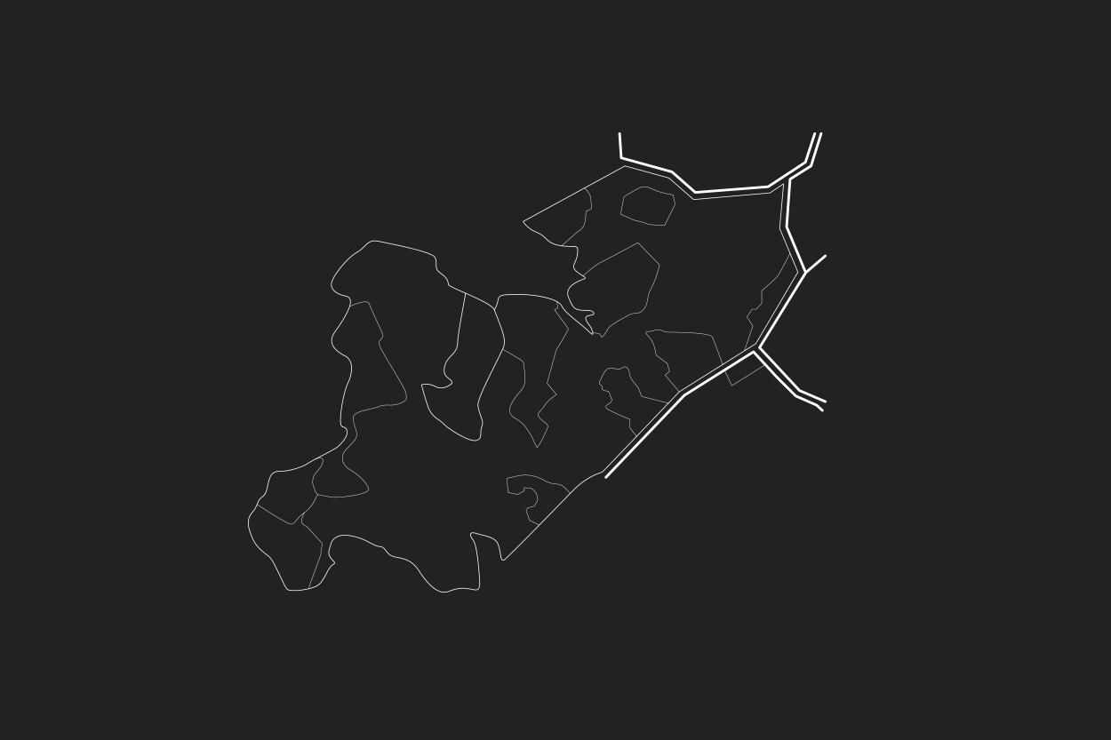
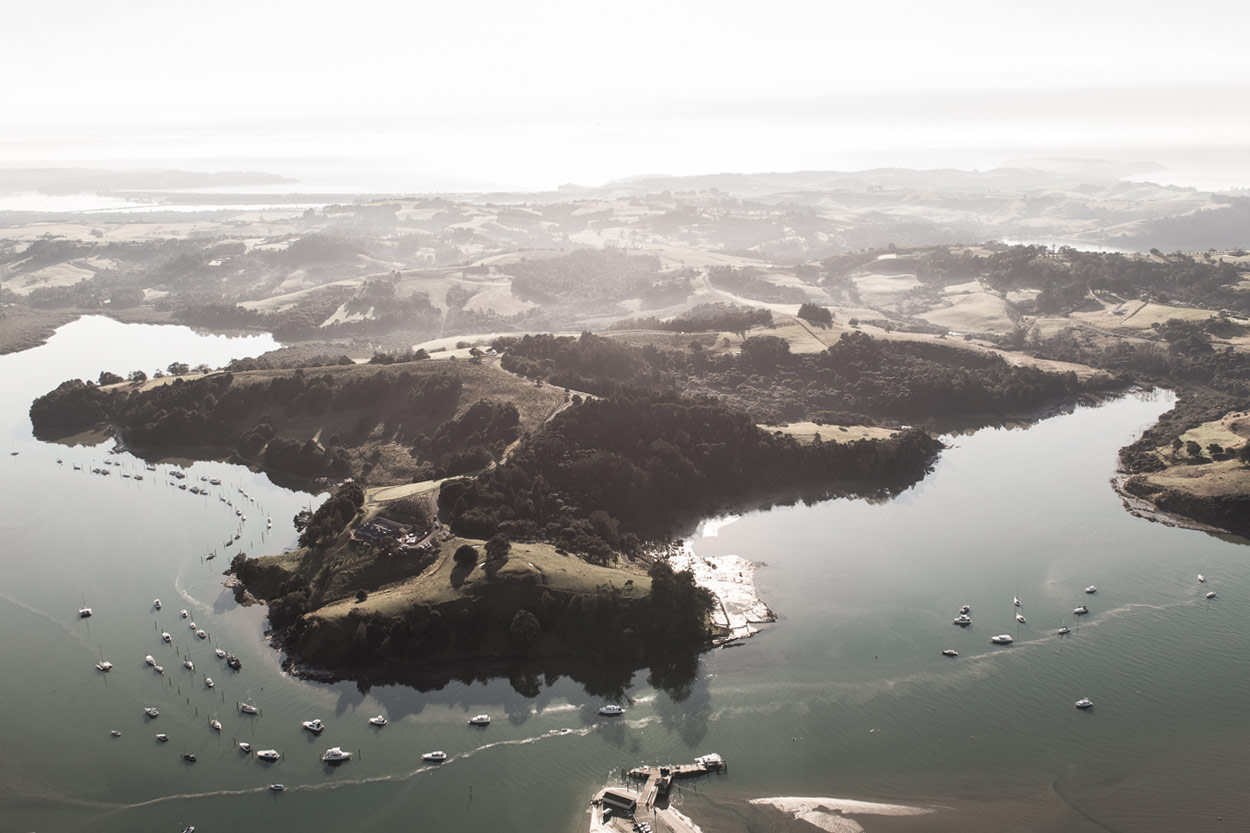
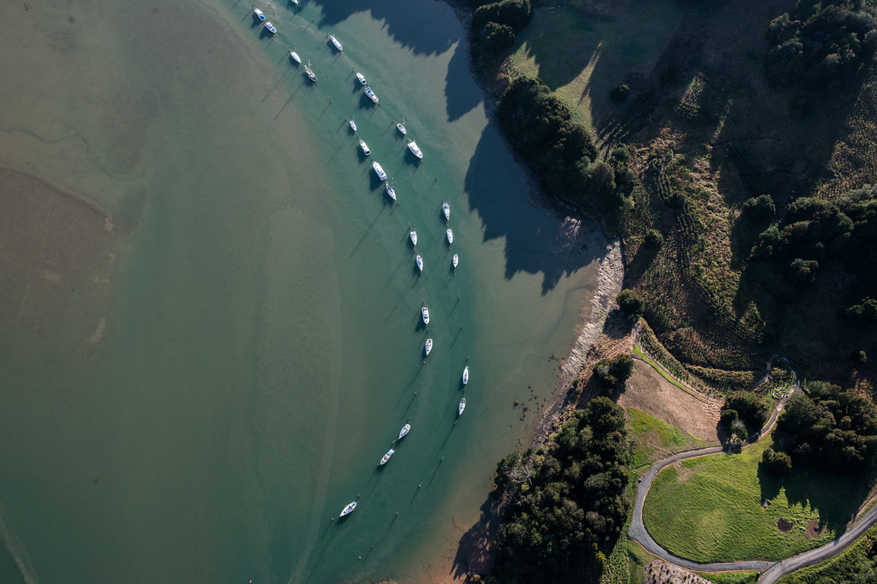
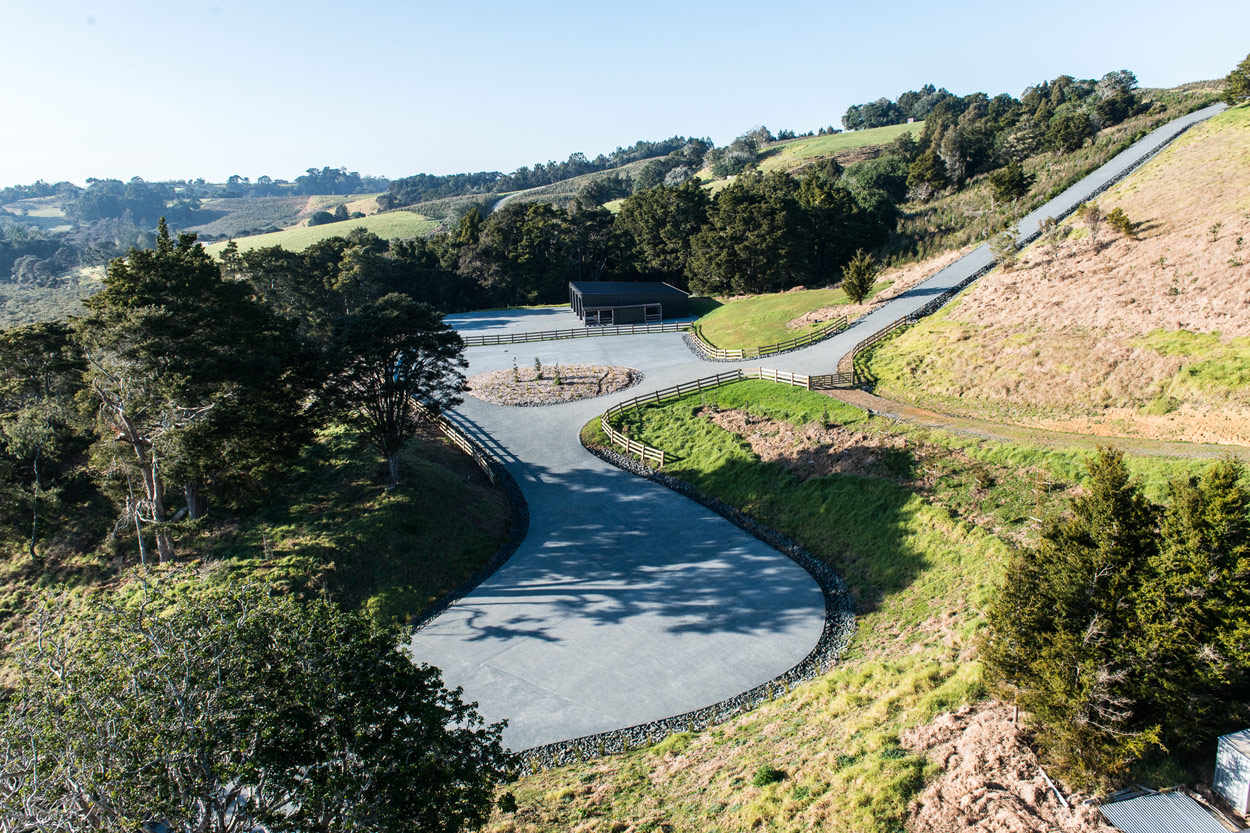
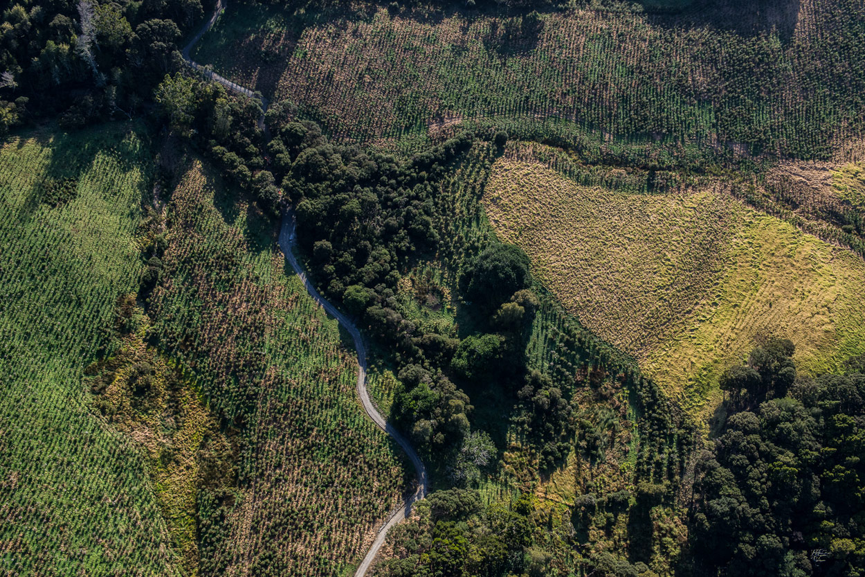
Bishops Hill is a 113.7 hectare lot of land located at Bishop Lane (previously Howelen Road) on the western side of the Tawharanui Peninsula, Matakana. The area has been developed into 16 individual residential lots as well as a significant area for shared use – including a boat ramp and pontoon, walking tracks, pa site, private roads and 45 hectares of natural native bush.
At a glance
- Project: Residential
- Location: Tawaharanui Peninsula, Matakana
- Size: 113.7 hectare
- Completed: April 2016
Bishops Hill Scheme DrawingBishops Hill OverviewBishops Hill Coastline DetailBishops Hill Boat Shed DetailBishops Hill Native Bush DetailBishops Hill Boat RampNext Project -
Bernard Magnus
Description
This 2.6 hectare development features 14 residential lots, accessible from either Bernard Magnus Lane or Shelter Drive, which run adjacent to State Highway 18 in Greenhithe. The development includes an extension of native riparian forest, watercourses, rain gardens and a reticulated sewer plan.
At a glance
- Project: Residential
- Location: Greenhithe, Auckland
- Size: 2.6 hectare
- Completed: November 2014
Bernard Magnus Scheme DrawingBernard Magnus OverviewNext Project -
Huntington Park
Description
The development is a 1.96 hectare area of land extending Huntington Park Drive in Greenhithe, adjacent to the northern side of State Highway 18. The area is developed into 25 residential lots and includes a wetland stormwater reserve.
At a glance
- Project: Residential
- Location: Huntington Park, Auckland
- Size: 1.96 hectare
- Completed: November 2014
Huntington Park Scheme DrawingHuntington Park OverviewHuntington Park OverviewHuntington Park Retaining WallHuntington Park Reserve StructureNext Project -
Blacks Road
Description
Blacks Road is a 5.3 hectare area of land located at the end of Blacks Road, Greenhithe. The land, which has steep terrain dropping towards a stream that crosses the property, is developed into 26 residential lots. The development includes new roads, access ways, retaining walls and a bridge. The significant natural bush in the area was preserved and more planted to create privacy in and around the area.
At a glance
- Project: Residential
- Location: Greenhithe, Auckland
- Size: 5.3 hectare
- Completed: April 2014
Huntington Park Scheme DrawingBlacks Road Scheme DrawingBlacks Road OverviewBlacks Road OverviewBlacks Road OverviewBlacks Road Bridge DetailNext Project